
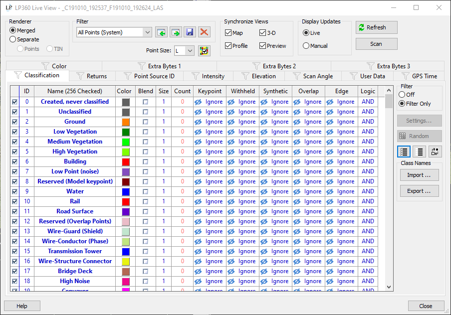
Live View tool for creating and modifying visualization filters has been extensively updated. Tools have been added for filtering by Point Source ID, Scan Angle, Elevation, and Intensity. Also added new overlay rendering for visualizations such as multi-level flood fill.
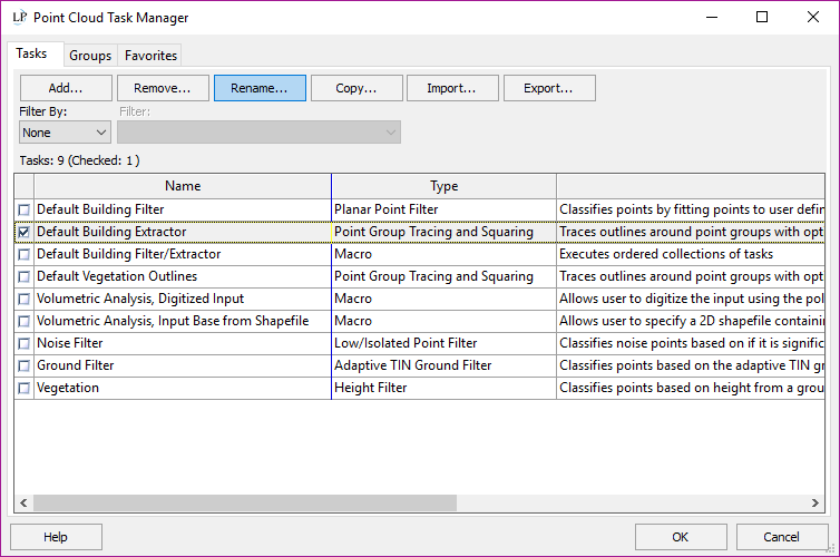
New Point Cloud Task Manager - The Point Cloud Tasks (PCT) Manager organizes PCT instances into user-named Groups for easy access. In addition there are Favorites buttons to allow quick selection of task instances from within a Group.
LIDAR seamline analysis tool added to LP360 (has previously been in LP360 for ArcGIS only)
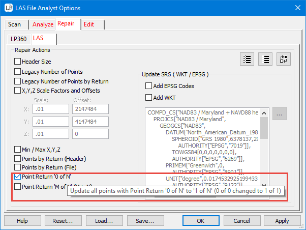
"Zero of Zero point return" correction tool added to LAS File Analyst
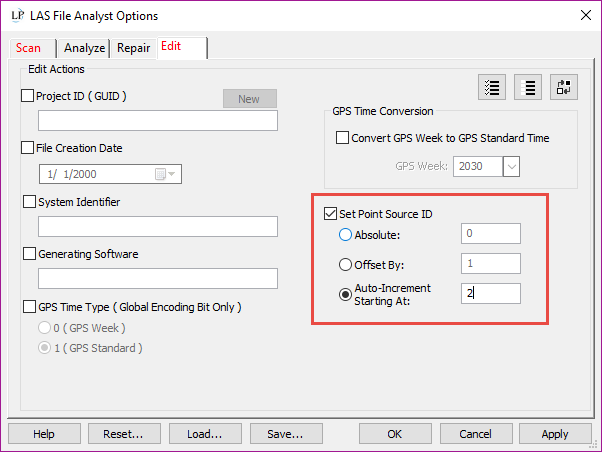
Renumber Flight Line Tool (Change Point Source ID) added to LAS File Analyst
Multithreaded to Improve Performance
Multithreaded Ground Classifier PCT - now 3x faster
Multithreaded the Basic Filter PCT - now 10x faster
Multithreaded the Export from Surface functions (e.g. export from surface to gridded raster) - obeys Nyquist sampling criteria, which is vitally important for dense data sets
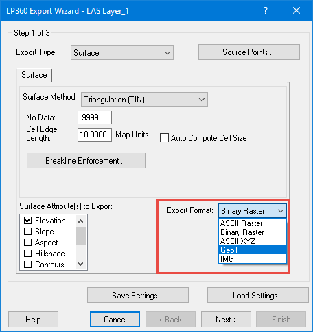
New Raster Export formats - GeoTIFF and IMG
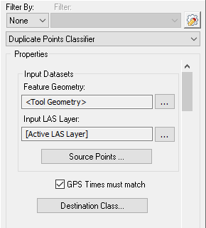
Added Duplicate Points Classifier PCT - Finds Duplicate points (points with both coincident geometry) and reclassify or flags the resultant points based on user selections.
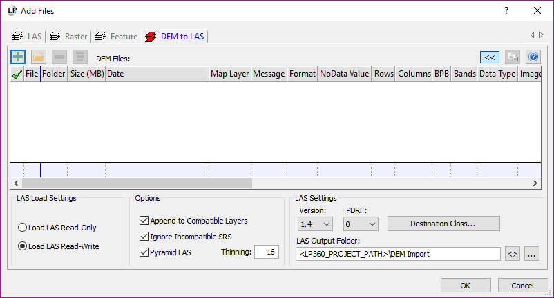
New raster DEM import function has been added to allow import raster DEMs with conversion to LAS
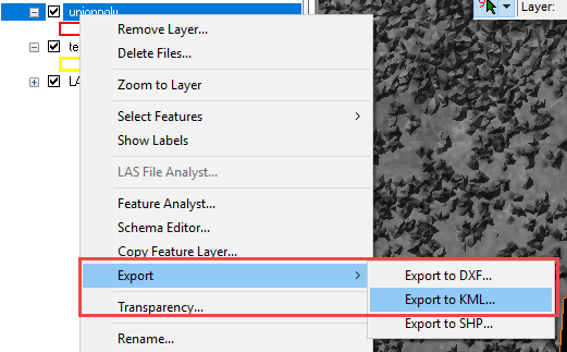
Import and Export of KML/KMZ files
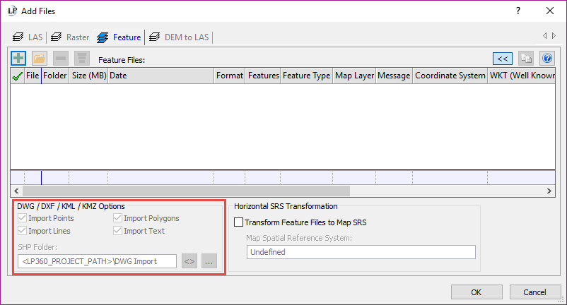
Transformation of the Spatial Reference System (coordinate system) on Feature import
![]()
Synchronize active LAS Layer mode added to Table of Contents - Allows rapid manipulation when more than one LAS layer is in use.
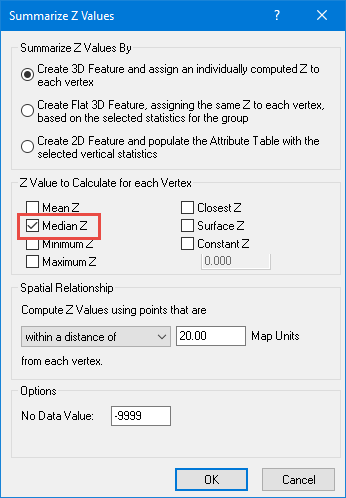
Statistical Median mode added to Conflation tools
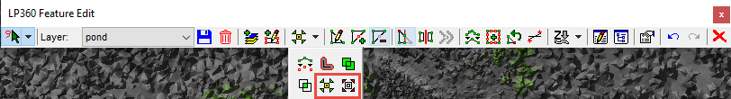
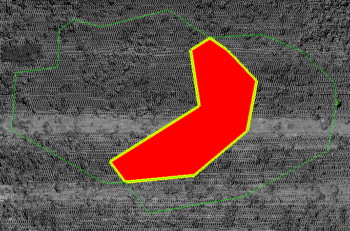
Merge lines mode added to Feature Edit Tools - Merge the geometry of two selected line features into a single feature on the same layer

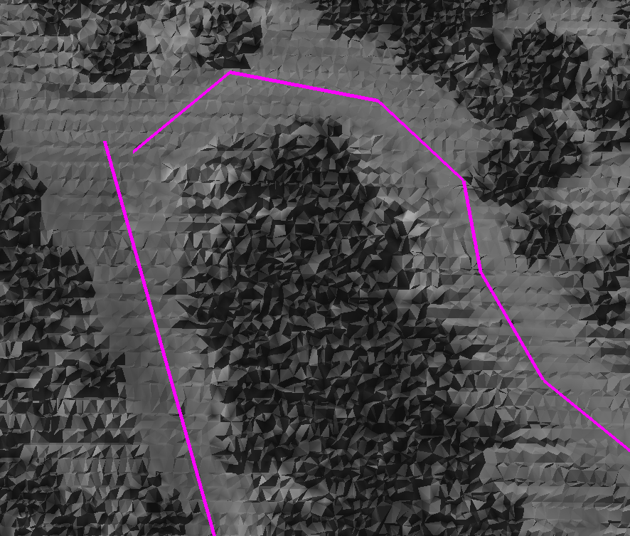
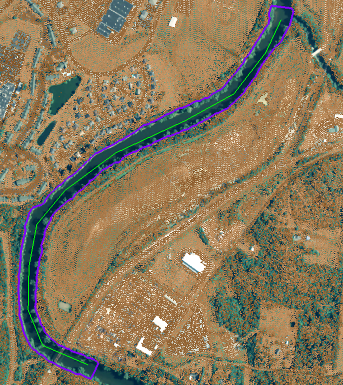
Double line Drain ("River Flattening") tool added to LP360 (has always been in LP360 for ArcGIS) - This tool projects Z values perpendicular from the centerline onto vertices of a polygon in order to flatten the polygon's surface to the flow of the centerline.

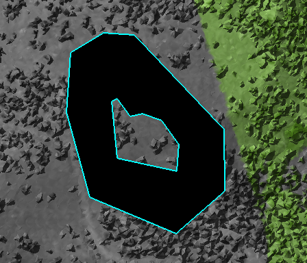
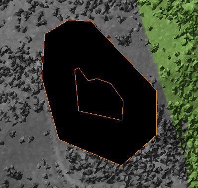
New edit tools to Disassemble and Assemble multi-part features
Added support for Australian Geoid: AUSGeoid2020.
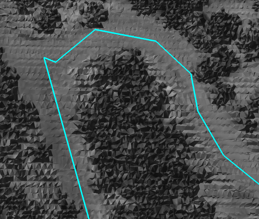
Added vertical and horizontal guides to the profile view when moving a vertex in the map view.
Added LPScanInfo command line executable that will generate the ".scan" XML file from an input LAS file.
Added Union command to Feature Edit toolbar that will union the selected polygons and create a single feature on the target layer.
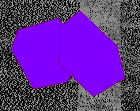

Added Intersect command to Feature Edit toolbar that will intersect the 2 selected polygons and create a single intersection feature on the target layer.
Bug Fixes